


Cecil County PUMA, Maryland
About
Outline

Summary
| Unique Area Identifier | 193058 |
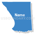
| Name | Cecil County PUMA |
| State | Maryland |
| Area (square miles) | 417.84 |
| Land Area (square miles) | 346.27 |
| Water Area (square miles) | 71.56 |
| % of Land Area | 82.87 |
| % of Water Area | 17.13 |
| Latitude of the Internal Point | 39.56235240 |
| Longtitude of the Internal Point | -75.94158430 |
Maps


Graphs
Select a template below for downloading or customizing gragh for Cecil County PUMA, Maryland


Neighbors
Neighoring Public Use Microdata Area (by Name) Neighboring Public Use Microdata Area on the Map
- Chester County (South) PUMA, PA
- Harford County (North & West)--Bel Air Town, Fallston & Jarrettsville PUMA, MD
- Harford County (South & East)--Aberdeen & Havre de Grace Cities PUMA, MD
- Lancaster County (East)--Ephrata Borough PUMA, PA
- New Castle County (South)--Middletown Town, Bear & Glasgow PUMA, DE
- New Castle County (West Central)--Newark City & Brookside PUMA, DE
- Queen Anne's, Talbot, Caroline, Dorchester & Kent Counties PUMA, MD
Top 10 Neighboring County (by Population) Neighboring County on the Map
- New Castle County, DE (538,479)
- Lancaster County, PA (519,445)
- Chester County, PA (498,886)
- Harford County, MD (244,826)
- Cecil County, MD (101,108)
- Kent County, MD (20,197)
Top 10 Neighboring County Subdivision (by Population) Neighboring County Subdivision on the Map
- Newark CCD, New Castle County, DE (68,723)
- Middletown-Odessa CCD, New Castle County, DE (52,453)
- Glasgow CCD, New Castle County, DE (39,748)
- District 3, Elkton, Cecil County, MD (27,001)
- District 2, Halls Cross Roads, Harford County, MD (24,862)
- District 5, North East, Cecil County, MD (22,773)
- District 6, Havre de Grace, Harford County, MD (14,577)
- District 5, Dublin, Harford County, MD (12,374)
- District 7, Port Deposit, Cecil County, MD (11,885)
- District 6, Rising Sun, Cecil County, MD (10,809)
Top 10 Neighboring Place (by Population) Neighboring Place on the Map
- Newark city, DE (31,454)
- Elkton town, MD (15,443)
- Glasgow CDP, DE (14,303)
- Havre de Grace city, MD (12,952)
- Perryville town, MD (4,361)
- North East town, MD (3,572)
- Rising Sun town, MD (2,781)
- Charlestown town, MD (1,183)
- Chesapeake City town, MD (673)
- Cecilton town, MD (663)
Top 10 Neighboring Unified School District (by Population) Neighboring Unified School District on the Map
- Harford County Public Schools, MD (244,826)
- Christina School District, DE (170,139)
- Cecil County Public Schools, MD (101,108)
- Appoquinimink School District, DE (53,855)
- Solanco School District, PA (31,827)
- Avon Grove School District, PA (30,080)
- Oxford Area School District, PA (25,814)
- Kent County Public Schools, MD (20,197)
Top 10 Neighboring State Legislative District Lower Chamber (by Population) Neighboring State Legislative District Lower Chamber on the Map
- State Legislative District 36, MD (137,167)
- State Legislative Subdistrict 34A, MD (85,098)
- State Legislative Subdistrict 35A, MD (84,725)
- State House District 13, PA (77,777)
- State House District 158, PA (68,769)
- State House District 100, PA (64,360)
- State Legislative Subdistrict 34B, MD (46,394)
- State House District 8, DE (34,905)
- State House District 9, DE (28,290)
- State House District 23, DE (22,367)
Top 10 Neighboring State Legislative District Upper Chamber (by Population) Neighboring State Legislative District Upper Chamber on the Map
- State Senate District 9, PA (277,401)
- State Senate District 13, PA (272,163)
- State Senate District 36, MD (137,167)
- State Senate District 34, MD (131,492)
- State Senate District 35, MD (128,326)
- State Senate District 14, DE (59,548)
- State Senate District 10, DE (48,282)
- State Senate District 6, DE (38,656)
- State Senate Districts not defined (Harford County), MD (0)
- State Senate Districts not defined (Cecil County), MD (0)
Top 10 Neighboring 111th Congressional District (by Population) Neighboring 111th Congressional District on the Map
- Congressional District (at Large), DE (897,934)
- Congressional District 1, MD (744,275)
- Congressional District 6, MD (738,943)
- Congressional District 16, PA (723,977)
- Congressional District 2, MD (700,893)
Top 10 Neighboring Census Tract (by Population) Neighboring Census Tract on the Map
- Census Tract 166.01, New Castle County, DE (11,362)
- Census Tract 148.05, New Castle County, DE (10,215)
- Census Tract 309.06, Cecil County, MD (8,572)
- Census Tract 148.07, New Castle County, DE (8,470)
- Census Tract 305.06, Cecil County, MD (8,223)
- Census Tract 3051, Harford County, MD (7,432)
- Census Tract 313.02, Cecil County, MD (7,236)
- Census Tract 143, New Castle County, DE (7,009)
- Census Tract 309.04, Cecil County, MD (6,814)
- Census Tract 312.01, Cecil County, MD (6,334)
Top 10 Neighboring 5-Digit ZIP Code Tabulation Area (by Population) Neighboring 5-Digit ZIP Code Tabulation Area on the Map
- 19702, DE (51,899)
- 19711, DE (51,322)
- 21921, MD (44,471)
- 19709, DE (35,107)
- 19713, DE (30,408)
- 21078, MD (17,603)
- 19363, PA (17,055)
- 21901, MD (15,875)
- 19734, DE (11,651)
- 21911, MD (11,004)